Start Planning · Province & region guide
Xinjiang: Two Journeys on Either Side of the Mountains
A turquoise lake in an alpine forest and a bread stall in Kashgar belong to the same region, but they belong to very different journeys. Xinjiang rewards a deliberate choice between its northern landscapes and southern oasis cities.
Xinjiang occupies China's far northwest. The Tianshan range divides broad northern and southern basins; the Altai rises farther north, while the Taklamakan fills much of the Tarim Basin. Distances are the first fact a traveler needs to understand. A marker on a national map can conceal a long drive or a flight. Choose a coherent area before adding famous names to a route.
North of the Tianshan: lakes, forests, and summer pastures
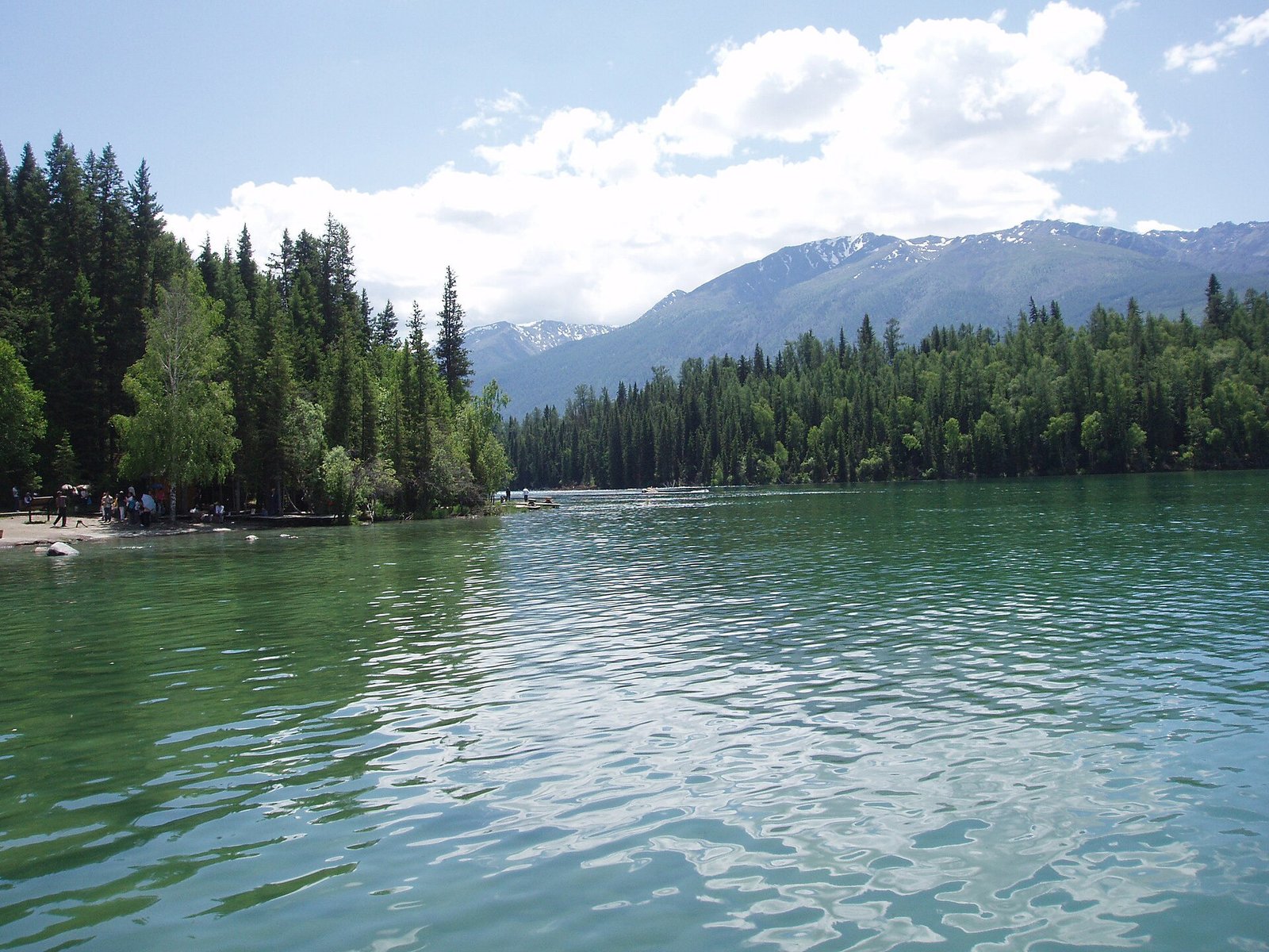
Kanas Lake lies in the Altai, where dark conifer forests meet water that changes from blue to green with light and conditions. The lake viewpoints and surrounding river bends are the main draw; Hemu offers a separate village landscape of timber houses and meadows. These are living communities, not a single enclosed attraction. Use established trails, ask before photographing residents, and allow time for scenic-area buses rather than expecting to drive to every viewpoint.
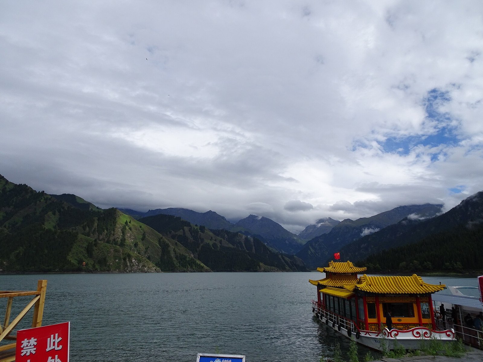
Heavenly Lake, also called Tianchi, is a different excursion in the Tianshan near Urumqi. Snowy Bogda Peak and spruce forest frame the lake. Its appeal is the contrast with the city and dry lowlands below. Urumqi's Xinjiang Museum gives useful context before the mountains: archaeological material, textiles, and exhibits introduce the region's many histories. Farther west, Ili's summer grasslands and Sayram Lake can become a journey of their own; they are not quick additions to a Kanas day.
A northern landscape journey
Use Urumqi as an entry point, then choose Kanas and the Altai or an Ili–Sayram route. These northern areas still involve long transfers.
A southern oasis journey
Give Kashgar several days and select reachable oasis or desert excursions. Add Turpan through a planned transport connection rather than as a casual Kashgar day trip.
Southern oases: follow the water, not the dunes
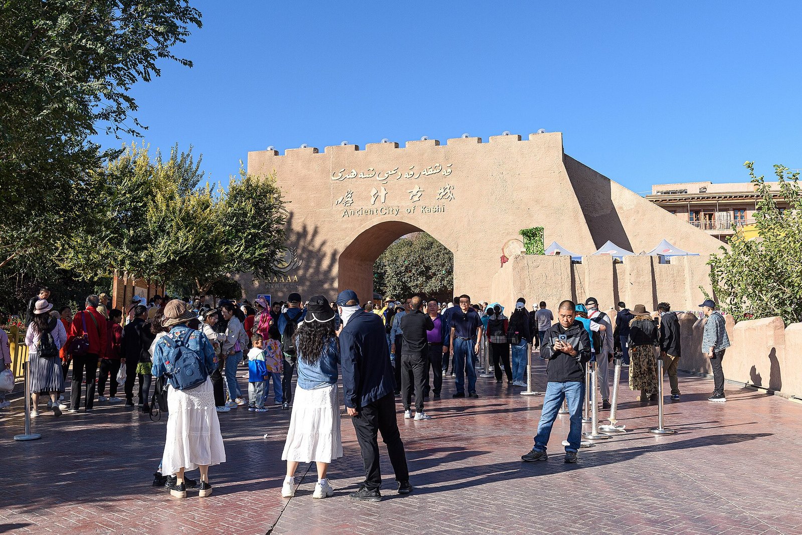
Kashgar Old City is best explored at walking speed. Rebuilt and restored streets coexist with residents' homes, workshops, bread ovens, and small businesses. Look for the rhythms of daily trade rather than assuming every picturesque facade is an untouched medieval building. The Id Kah Mosque is an important landmark; entry arrangements and photography rules need checking locally. Religious practice deserves quiet observation, not a staged encounter.
The Taklamakan Desert explains why the old trading towns developed around water. Roads skirt or cross a vast dune landscape, but an organized desert excursion and an independent remote crossing are entirely different undertakings. Heat, sand, fuel, communications, and current access arrangements require careful planning. Turpan adds an especially readable oasis story: Jiaohe's earthen ruins show the outline of an old city, while karez irrigation introduces the engineering behind cultivation in an extremely dry place.
What the Silk Road left in everyday life
Trade moved goods, religions, languages, and techniques through a network of routes rather than one highway. Uyghur, Kazakh, Hui, Han, and other communities contribute different traditions to Xinjiang; their identities should not be reduced to one costume or menu. In markets, look at bread stamps, dried fruit, metalwork, and musical instruments, and ask a local guide what you are seeing. A useful guide can distinguish an ordinary neighborhood shop from a visitor-oriented performance.
Food is a particularly direct introduction. Naan comes in different shapes and textures; polo combines rice with carrots and often lamb; laghman pairs pulled noodles with a substantial vegetable-and-meat topping. Lamb skewers, big-plate chicken, and seasonal grapes and melons are further possibilities. Halal practice matters in many establishments. Confirm ingredients, respect a restaurant's rules, and do not bring outside pork or alcohol into a place that prohibits them.
Make the route fit the season
The region is generally dry, but it has no single travel climate. Turpan can be intensely hot in summer, Kanas has a long cold season, and mountain evenings can be chilly when basin cities are warm. Summer and early autumn are often useful for northern landscapes; southern cities can suit shoulder seasons better. Carry layers and sun protection and check conditions for the exact area.
A first visit might concentrate on Urumqi and a northern lake-and-grassland circuit, or on Kashgar and selected southern oases. Combining both needs substantially more time. Keep identification available, confirm current foreign-visitor access and accommodation arrangements before remote travel, and leave room for long transfers. The reward is a region understood through its contrasts, rather than a collection of hurried photo stops.